

Despite its commercialization during the last five years,
Sapa is still a must-see on any northern Vietnam itinerary.
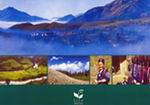
On a clear day you will treated to views of steeply terraced
rice fields, towering verdant ridgelines, primitive
mud-thatched villages, raging rivers and astounding
waterfalls. Nestled high in the Tonkinese Alps near the
Chinese border, Sapa was built as a hill station during
French colonial days, to serve as a respite from stifling
Hanoi summers. These days, weekends are still the biggest
draw in this crumbling hill-tribe center. Visitors from the
capital flock to Sapa for a glimpse of the famed "Love
Market," a trek to local hill tribe villages, or an ascent
of Vietnam's highest peak, Fan Si Pan.
sapa has the feel of an alpine resort. The architecture
is a mix between French colonial and traditional
Vietnamese (often painted in a bright ochre or mustard)
derived styles. It's common to arrive early in the
morning and there's often a very enthusiastic welcome
awaiting the sleepy tourist, providing an opportunity
for a rapid acquaintance with the local minority people.
To get to Sapa, the most common routes are by train to
Lao Cai and then mini bus, or by driving. The route to
Sapa twists it's way around steep slopes and as the
height increases the vegetation begins to change from
the bright green familiar tropical varieties to a more
alpine kind.
Traditionally tourists make either a north-south run
down Vietnam from Hanoi to Ho Chi Minh City or a
south-north run up, and this unfortunately means you
miss Sapa, one of the most breathtaking places in
Vietnam.
Influented by temprate and subtropical climate, the
weather in Sapa is cool around year. The average
temprature is 15?C. May to August is rainny season. The
average rainfall is 1,800mm a year.
See also
The Tay's history and social life(01/04/2008)
The Dao's history and social life in Sapa(12/29/2007)
The Hmong's history and social life in Sapa(12/19/2007)
Sapa history(12/19/2007)


